Planning for India's new industrial future
Delivering a comprehensive masterplan for a new industrial city in India of approximately 500,000 people as part of the Delhi-Mumbai Industrial corridor
10 min read
This post describes the process of putting together a comprehensive development plan and concept urban design masterplan for a new industrial city in India for approximately 500,000 people on a so called 'greenfield' site. The new city was to form part of a landmark national infrastructure project for the Indian Government. The consulting assignment was divided up into three broad stages: Market Analysis + Site Selection and Conceptual Masterplan, and Development Plan and Key Area Design Schemes and was delivered over a period of approx. 2 years. Key learnings are presented at the end of the post.
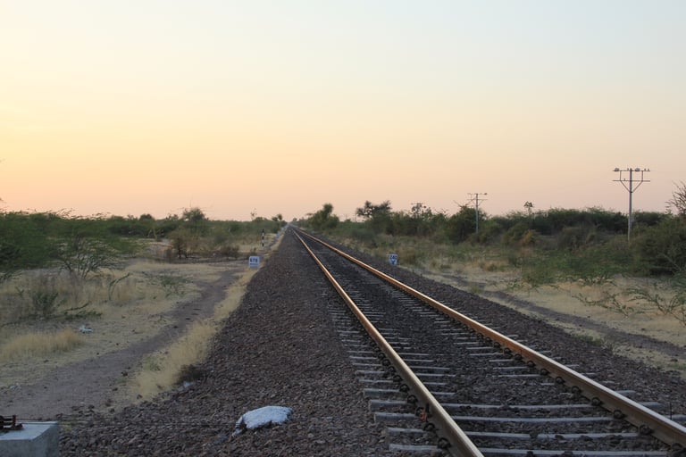
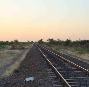
It all started with the railway line
DMIC
The planned city forms part of an unprecedented massive national level infrastructure project that is set to become the motor of the Indian economy: The Delhi–Mumbai Industrial Corridor (DMIC). Launched in 2006, the DMIC project is one of the world's largest infrastructure projects with an estimated investment of US$90 billion. The corridor comprises a revolutionary dedicated multi-modal freight corridor with strategically planned industrial cities and hubs spread across its 1,500 km long length from the capital Delhi to its financial and international shipping hub Mumbai.
The DMIC emerged during a pivotal period in India's economic trajectory. The government sought to increase manufacturing's share from 15% to 25% of GDP. DMIC was conceived as the vehicle to achieve this, particularly after China's success with similar corridors. Projections showed 800 million Indians would live in cities by 2050. DMIC's planned 24 smart cities aimed to accommodate this urban influx while avoiding chaotic urbanization patterns seen in Mumbai and Delhi. Since my involvement in the project, it has encountered many delays. In spite of this, the DMIC has seen progress in certain development centres like Dholera (Gujarat) and Greater Noida (Uttar Pradesh). As of recent reports, the western freight corridor is nearing completion, though overall progress stands at about 45% against original timelines . The project remains central to India's industrial transformation strategy, now complemented by four additional planned corridors to create a "diamond-shaped" economic zone across the country .
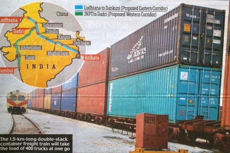
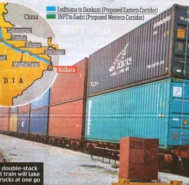
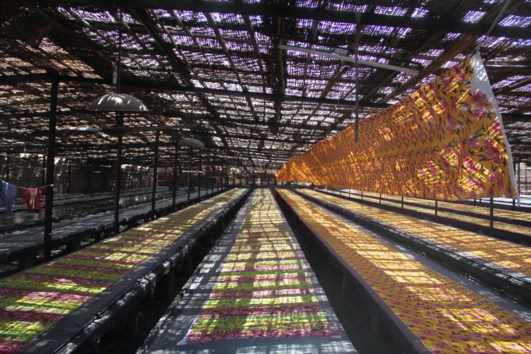
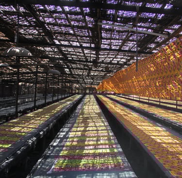
The dedicated freight corridor in the national news
How to conceive of a major new industrial town along the route?
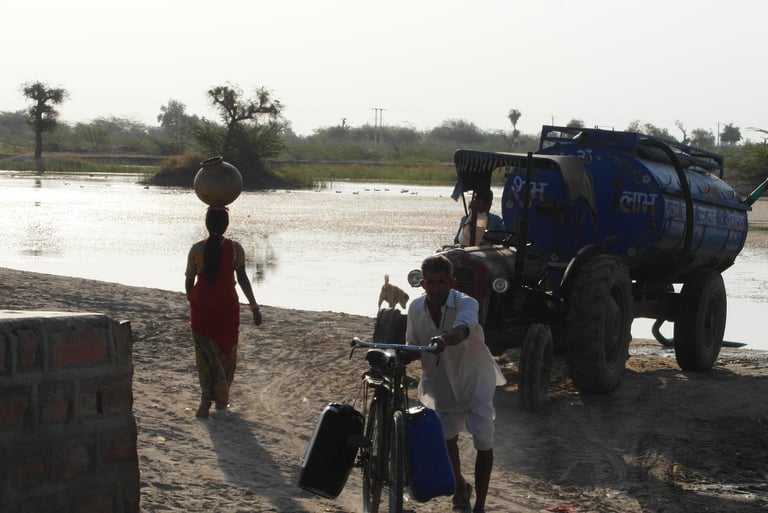
My firm were brought in as lead consultants to prepare a development plan along with several feasibility studies for infrastructure projects tied to the city. The chosen area would be one of 24 "nodes" along the 1,500km route, in a poor part of India and in a harsh desert-like climate with water significant water scarcity. Part of our brief was to identify the optimal location for the new town within a thousand sqm study area. Teams of economic and spatial planners worked concurrently on a comprehensive market analysis and an initial site selection process involving a comprehensive land suitability analysis study. After several exhaustive rounds of data collection and analysis, we identified three potentially favourable major development sites. The analysis was done in two stages with a series of weighted indicators used to assess the suitability of land parcels we had devised as part of a GIS-based analytical approach.
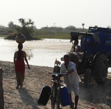
In the study area we observed existing cottage industries and how each village used carefully managed traditional rain water harvesting techniques
Initial stakeholder consultation took the form of visiting various local and regional government departments, and informally talking to locals at several villages. We utilized an initial draft economic study to provide an indication of likely forecast industrial development types and quantum (under different economic scenarios) with associated infrastructure gap assessment. Fron this we then included several spatial scenario studies to test different options for a major city development based on the overarching objectives of the DMIC project.
From these studies, we were able to come up with growth and spatial developments targets spanning a 30 year planning horizon. The predicted population would be about half a million with an urban footprint of about 70sqm. Requirements for water and power were also incorporated into the study.
The comprehensive GIS-based land suitability analysis supported a preliminary location assessment with three shortlisted options for the location of the proposed town within a 10,000sqm initial study area. Having narrowed down the three approximate locations, we then set about a second stage more detailed study of the pros and cons of each site option weighed against a series of indicators. The choice and weighting of suitability indicators for the three distinct sites was based on things like availability of developable land; transport connectivity; available water and power supplies; availability of quality labor force; land acquisition costs as well as minimizing the displacement of existing inhabitants.

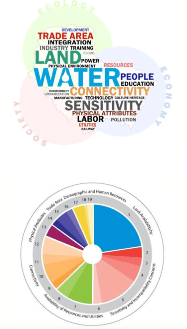
Considerations for site selection - themes and indicators
In the land suitability analysis, 31 indicators indicators were chosen which were weighted according to a set of guiding principles. The indicators and weighting system was formulated based on extensive research, expert opinion and the concerns of key stakeholders.
The final proposed location was agreed to be the most economically, socially and environmentally suitable for the development of the industrial city following a series of consultations with local officials and invited stakeholders. After several rounds of presentations to different stakeholder groups, the eventual preferred option was approved by the State Government. As part of this, an over-arching vision statement was agreed. The new city development will contribute towards sustainable development of the region, delivering a world class, sustainable manufacturing area and associated town which has the potential to bring about equitable development for both locals and incoming residents.
The objectives in the 30 year plan included the establishment of a holistic low carbon development model, starting with a deep understanding and appreciation for the social and environmental context. This included things like combining and integrating traditional water management know-how with modern technology and systems, the widespread use of passive design techniques; harnessing the potential of renewable energy sources, developing a mechanism and targets for the delivery of zero/minimum waste, including waste-water treatment; developing a mechanism and targets for a sustainable integrated transport system with minimum carbon emissions; and finally, providing detailed design guidance for land use and community development to ensure flexibility, adaptability and choice for diverse communities.
These objectives helped lay the foundations for the design of the concept masterplan.
Designing a Concept Master plan for the chosen development site
After approval from the State Government, the next stage in the process was to go back to the chosen development site, examine it in much further detail and start to formulate a concept masterplan based on the goals set out in the over-arching vision and strategy document.
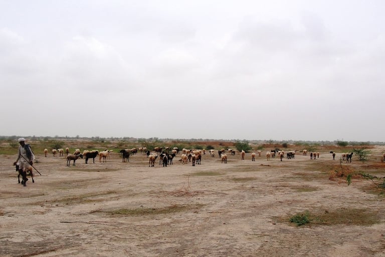
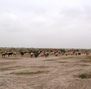
Nomadic herding within the area
The existing site context was made of semi-arid rural lands with several scattered villages, a main road corridor and a parallel rail corridor. The topography was flat, and very dry with sporadic hilly outcrops/ridges.
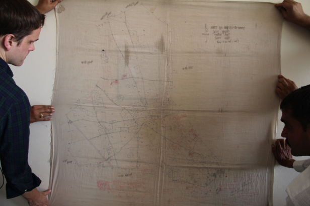
In terms of data collection, there were no digital maps available to help form a basemap. The closest thing we had to a cadastral survey of the study area was hand drawn maps on cloth that were 60 year old. There were also no high resolution satellite images to work with neither.
The approach we took was to take a photo of each hand-drawn cloth map - there was one per village unit - at the highest possible resolution and as orthogonal as possible, then photoshop them and then trace the property lines in AutoCAD – a very time-consuming effort! A third party land surveyor was then hired to assist with the process of preparing topographically accurate, geo-referenced CAD basemaps.
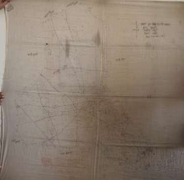
The starting point in the digitized mapping process
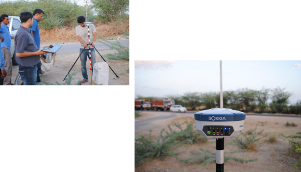
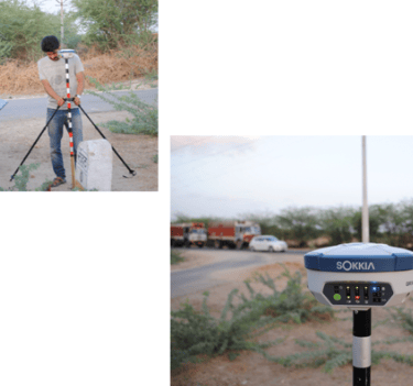
Setting up Ground Control Points for the land survey
Rounds of informal community consultation took place as we visited several villages in the area and talked to the villagers. They were all very friendly, welcoming and curious. One village elder sat us down for tea outside his earth hut. Noticing that we had some Chinese team members, he spoke about a time he recalled when he was younger when India and China weren’t very friendly. But that was 'all in the past'.
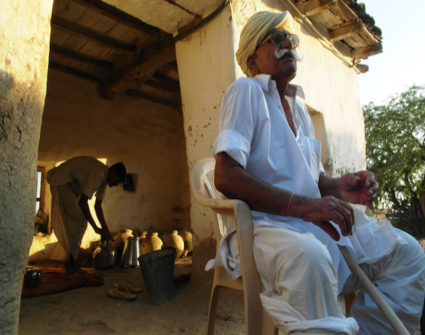
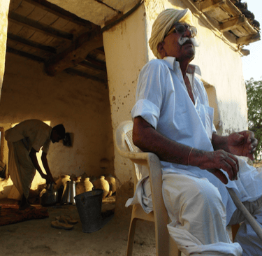
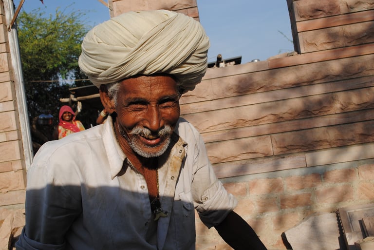
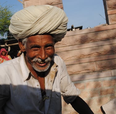
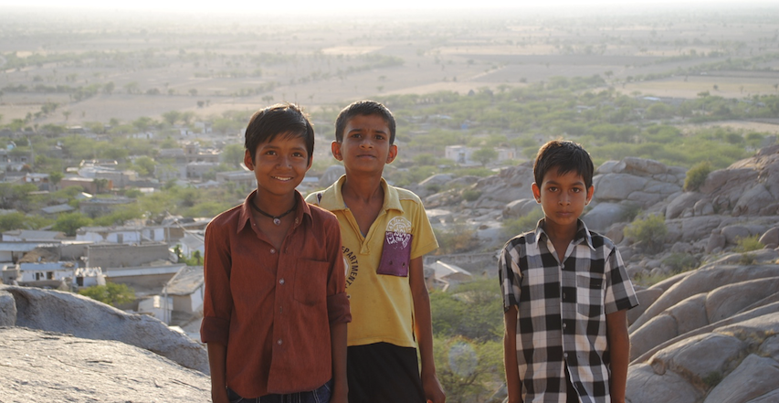
Local villagers always appeared with beaming smiles and were very welcoming
With sufficient analysis undertaken using digitally accurate base maps, we started to explore some spatial development concepts. We were required to come up with alternative masterplan options.
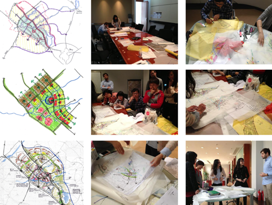
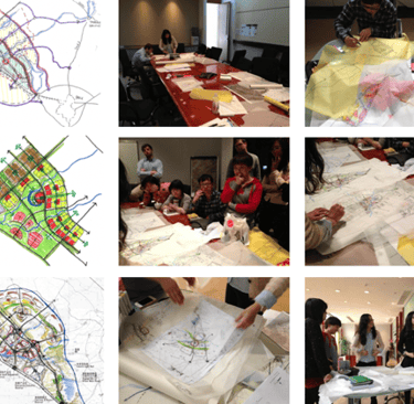
Exploring potential spatial development concepts for the site following a two day intensive, multi-disciplinary design workshop
Three options were chosen to be taken forward as alternative masterplan. Each proposal had distinct design approach with it is own distinct urban morphology offering advantages and constraints. The three options were refined to a point in which they became formal concept proposals including spatial structure concepts, high level strategies for movement, functional areas, landscape, services etc. The three options were given an identity based on their urban form: “modular grid city”, “concentric radial (garden) city” and “linear grid city”.
After making some refinements to test the feasibility of the concept designs, we developed a bespoke Comparative Evaluation Scoring Matrix to judge the merits of each option as objectively as possible, taking on board a wide range of considerations including the surrounding context, as well as the principles of sustainable development we had set out and agreed with key stakeholders in earlier stages.
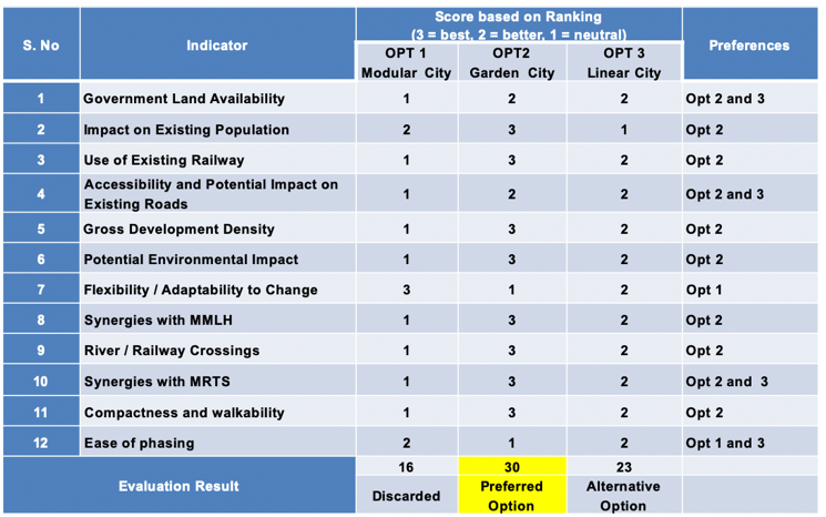
Comparative Evaluation Scoring Matrix for three design options
Ultimately, the concentric garden city was chosen as the preferred spatial development concept by the client, following the presentation of the comparative evaluation. The town will thus be developed in a concentric radial pattern that can be delivered in self-sufficient modules (or ‘wedges’) of development clusters encompassing both residential (and associated required services and open space) and commercial (mostly industrial) lands.
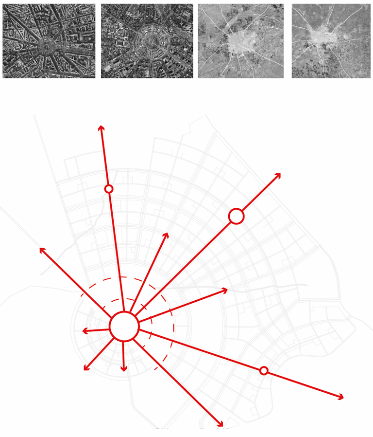

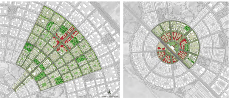

Details from the concept masterplan - core area (right) and central spine (left). The commercial core area is served by a regional commuter train station at its centre
The concentric radial structure and arrangement of a commercial core, residential inner ring, and industrial outer ring, facilitates a degree of flexibility and coherency that will ensure balanced development, providing all functions of living, working and doing business within easy reach of the living areas. The concentric radial form was also seen as advantageous in ensuring segregation of heavy vehicular traffic in the outer industrial areas from living quarters in the inner rings, and the commercial core. The configuration of the land use mix was also based on the prevailing wind direction and natural drainage pattern.
Closing thoughts
The Delhi-Mumbai Industrial Corridor represents one of the most ambitious government projects in India and perhaps globally. If successful it could see India take over from China as the world's global manufacturing powerhouse fuelled by a logistics revolution. Ultimately, this is very much a top down planning effort. The success of the project will rest with matching bottom up, grass-roots initiatives that will provide local support and ensure engagement from the widest possible groups of stakeholders. Within this context, a more dynamic, action-oriented, flexible and realistic approach to mega-project planning is warranted as part of the implementation. The scope and nature of the master plans should move away from a ‘predict and provide’ model, to a more strategic and flexible planning approach; one that is incremental with design-oriented, iterative cycles of consulting, analysing, testing etc. Planning teams should have a full understanding of the urgency of issues, structures of power in the area and possibility for cooperation between actors, to co-produce an over-arching vision that has buy-in at every level. The vision should then inform a guiding set of principles, which in turn form the basis for developing the various strategies (spatial, economic, social, etc) that make up the components of the Development Plan.
The current draft development plan for the city is 385 pages covering many different facets – environmental, social, economic - of the existing regional context and proposed new town. Delivering such a report is naturally a massive and highly complex undertaking which took expertise from a lot of disciplines. For this assignment we used design as a research tool at various stages to explore issues, synthesize information and test possible outcomes. We also leveraged available technologies to support evidence-based decision-making as much as possible. We used GIS at several stages to synthesise layers of spatial information and support critical recommendations such as the optimum location for the new town. The staging of scenarios was also key tool to help frame the debate amongst stakeholders on a range of possible futures; and enabled us to gain consensus on areas that initially appeared in conflict.
On a personal level, the experience of this assignment afforded me great insights into Indian culture and resourcefulness. In order to thrive under extreme climate conditions and very limited and irregular water supply, there have been some incredible innovations in things like rainwater harvesting that have been preserved over the centuries. Contemporary planners and policy makers need to recognize and learn from these achievements in laying the foundations for future sustainable development. The most enjoyable and rewarding aspects of this assignment were the opportunities to meet new people from diverse backgrounds, share ideas, experiences and most importantly learn from one another. I was blown away by the ingenuity, resourcefulness and warmth of the Indian people. I am also grateful to have collaborated with some very talented spatial planners in India who remained dedicated to the project throughout, not to mention several colleagues in China who demonstrated great technical and creative talent to solve problems and overcome challenges in a collaborative way and who made invaluable contributions to the project at various stages.